Highland Road
A Journey around the North Coast 500
Gordon MacLeod
20 January 2017.
Highland Road is the story of a clockwise journey around the North Coast 500 road route in the far northern Highlands of Scotland. My journey had several detours and diversions from the mapped route but it also had more than a dozen metaphorical detours into topics, that were triggered by, or associated with, places around this Highland road. These topics were diverse and various ranging from geology and landscape, through Gaelic place names, two novelists, a poet, a brief excursion into Scottish church history, and fishy tales as in herring and salmon.
The entire book is downloadable free of any charge in Portable Document Format (pdf). The materials may be freely used provided that appropriate attribution to the writer, as copyright holder, is made. Similarly, appropriate credit to the photographers should be made. Mostly, the photographs are copyright Gordon MacLeod unless otherwise identified.
The pdf files are provided in two levels of compression. The ‘larger’ files have been subject to medium compression with image reduction to 300 dpi. The ‘smaller’ files have also been subject to medium compression but their images have been reduced to 72 dpi . This reduces image quality quite markedly. Therefore, if your bandwidth permits, I suggest that you download the larger files.

Chapter 1 (Getting There, and where is “there”?) tells of my somewhat-confined and lengthy travels from my home on the beautiful north coast of New South Wales, Australia to the beautiful north Highlands of Scotland. The larger file of this Chapter is here (612KB); the smaller file is here (238KB).
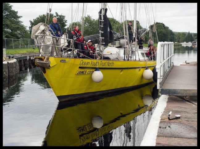
The second Chapter (Inverness: The Journey Begins) tells of my visit to Inverness, both the city and some of the sites around it. One of these visits was to the Caledonian Canal in Inverness and my first figurative detour relates some of the works and life of master engineer, Thomas Telford. He was the Scots-born builder of canals and aqueducts, roads, bridges and gaols. His work did much to open up the north Highlands. Chapter 2 is available here as a larger file (1.3MB) and the small version is here (409KB).
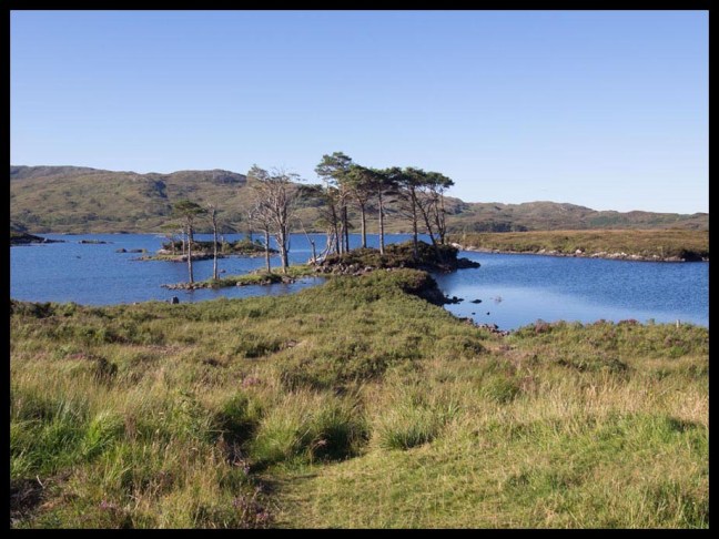
Next I travelled to Lochcarron (Chapter 3 To Lochcarron, Bealach na Bà and Applecross). The trip from Inverness traversed not only Telford’s canal but also his line of road from east to west. I do encourage travellers to diverge from the mapped route of NC500 so as fully to enjoy the diversity and beauty of the north Highlands. My first such detour was to the Isle of Skye and to Eilean Donan Castle. Back on the road, I explored the environs of Lochcarron and went hunting for a church said to be designed by Sir Christopher Wren. I then crossed over the Bealach na Bà to the fascinating Applecross Peninsula. In the short distance between Lochcarron and Applecross, the landscape changes dramatically. This change is fashioned by the underlying geology and geological events. My first detour in Chapter 3 is therefore on geology and its effects on the landscape of the northern Highlands. The second detour in this chapter is on Gaelic names and naming and on whether we are losing our capacity to deal with our living landscape through our loss of the languages that underlie the naming of places and features. The larger pdf of Chapter 3: Lochcarron, Bealach na Bà and Applecross is here (4.2 MB). The smaller version is here. (998KB).
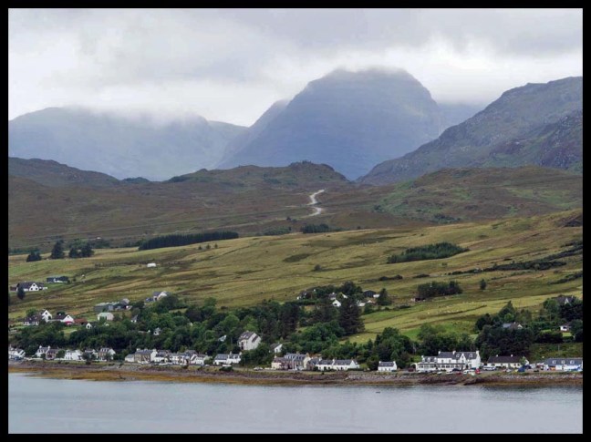
In Chapter 4 (Shieldaig and Gairloch) I explored these two townships as well as the superb Torridon mountains, and beautiful Loch Maree and Slioch that lie beside the road route between the twonships. My stay in Shieldaig, on a superb summer’s evening, was suddenly marred by an attack from the dreaded midge. These insects became the subject of the first detour in this chapter. A second detour provides information on the WalkHighlands organisation. Its website provides comprehensive coverage of strolls, walks, adventures, climbs and trails around Scotland. The third detour provides an introduction to a very small part of Scottish church history. It is particularly apposite in this area where, for some time, there were to be found open-air church meeting places rather than church buildings. The larger file is here ( 5.9MB). The smaller file is here (1.2MB).
I next travelled to Ullapool, at one time alleged to be a ‘nest of wickedness’. It appears to be no longer such but is now much more of a fishing port, ferry terminal (for Stornoway in the Isle of Lewis), regional service centre and tourist destination. Here I visited the Museum located in a former Parliamentary Church. This led to a detour into a brief telling of the story of these churches. The larger file for Chapter 5 (To Ullapool: “a nest of wickedness”?) is here (2.5MB); the smaller file is here (579KB).
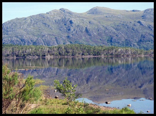
I travelled north from Ullapool, past Coigach, through Assynt to Lochinver. Along the way were the Visitors Centre at Knockan Crag (where the Moine Thrust is visible) and then Loch Assynt, with its tales of derring-do and some treachery and knavery by the MacLeods and Mackenzies. Near Lochinver were the dearly loved summer hide-aways of one of Scotland’s favourite poets, Norman MacCaig. I recall him with much fondness in the detour and review devoted to him. From Lochinver, I took a diversion on the ‘wee mad road’ to the south and then the almost equally eccentric loop of NC500 past the machair and beach at Achmelvich along single track, undulating roads through Clachtoll, Stoer and Drumbeg and then back below the slopes of the imposing Quinag. Chapter 6 (Lochinver and the wee mad road) is available in a higher fidelity file (3.4MB) and in a smaller file here (817KB).
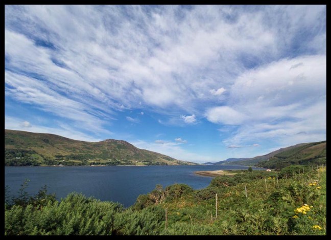
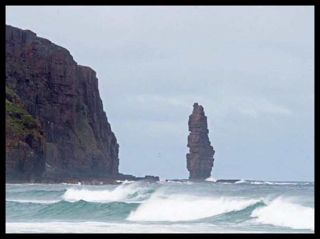
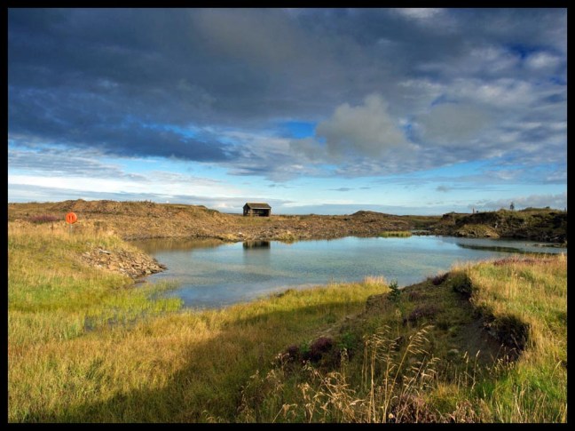
Diversions were the order of the day as I drove north from Lochinver on the west coast towards Durness on the north coast. Travellers should not omit diversions unless from necessity. The first of my diversions was to the bird haven of Handa Island, not far north of the interesting village of Scourie. I then travelled further north past Laxford Bridge where I once more turned off the NC500 route towards the fishing port of Kinlochbervie and then the superb beaches at Oldshoremore and Polin. I then reached the car park at Blairmore where the walking track to Sandwood Bay begins. Although it is a 14km return walk to this magnificent and atmospheric beach the excursion has, for good reason, become a highly popular one. After this, I headed north to Durness, nearest village to Cape Wrath. Along the way I passed salmon rivers, a salmon farm and some mostly abandoned peat bogs. Salmon and peat became the subjects of my next two detours. The village of Durness on the north coast of Scotland is of interest for its beaches, its distinctive and sometimes bloody history and the huge limestone Smoo cave. My visit is described in Chapter 7 (North to Durness via Sandwood Bay) in a large downloadable file here (4.3MB) and in a smaller version here (881KB).
I next drove from Durness eastwards along the North Coast past Ben Hope and Ben Loyal. After Tongue and close to Bettyhill I took another diversion into Strathnaver to visit the ruins of the cleared village at Rosal. The detour of this chapter concerns Iain Crichton Smith’s moving Clearances novella, Consider the Lilies, which is set in a not entirely fictional Rosal with some not entirely fictional characters. From Rosal I drove back towards Bettyhill and east to Farr where I dined and wined well in a Bed and Breakfast establishment run by a former professional chef. Chapter 8 (Across the top to Bettyhill) is downloadable here (2.9MB) and in a smaller version here (579KB.

I continued to drive eastwards. Almost suddenly, I left behind the hills of Sutherland and arrived on the flatlands of Caithness. Unexpectedly, there appeared the iconic white dome of the former Dounreay nuclear reactor. This became the topic of my first detour of Chapter 8. My base for a few nights was Thurso. From here, I explored the Castle of Mey (former home of the late Queen Mother), John O’Groats, and Dunnet and Duncansby Heads. My most interesting excursion was to Achanarras where an abandoned flagstone quarry has been made available to fossil hunters by Scottish Natural Heritage. Here, I found both a fossil fish and a piece of water-rippled sandstone that must have rested at some point on the bottom of Lake Orcadie. The larger file of Chapter 9 (Land of the Horizontals) is here (3.1MB) ; the smaller one is available here (670 KB).
Chapter 10 (Wick, Dunbeath and Helmsdale) covers my travel along a chunk of the northeast coastal strip from Wick through Dunbeath to Helmsdale. My first ‘port of call’ was the Caithness Broch Centre and the nearby Broch of Nybster. Brochs are the subject of the first detour in this Chapter. I then drove to Wick, once the largest herring fishing port in Europe. This fact gave rise to a second detour into herring. Wick incorporates Pulteneytown, designed by Telford to accommodate the large numbers of people associated with the herring fishing boats that filled the Telford-designed Wick Harbour. Southwards from Wick were several interesting archaeological sites as well as the former herring ports of Whaligoe, Lybster, Dunbeath and Helmsdale. This was a land well known to 20th Century novelist Neil M Gunn, who was born in Dunbeath, several of whose novels are set in this part of the world. A third detour reviews three of these works: Butcher’s Broom, Highland River and Silver Darlings. This Chapter is available as a large file here (6.7MB) and as a smaller file here (1.4MB).
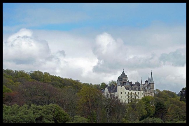
I headed south to Golspie. This village was the focal point for decisions about the Sutherland Clearances. Just to the south of the village lived assistant-factor Patrick Sellar and his nemesis, Sheriff-substitute Robert McKid. Just inland from Golspie lived factor William Young, Sellar’s boss. On top of Beinn Bhraggie, way above the Young home, was the massive statue of the first Duke of Sutherland. This was supposedly caused to be erected by his grateful tenantry and this claim led a travel website to describe Golspie as ‘home to one of the world’s most laughably dishonest monuments.’ Just to the north of the village is the Golspie Inn, site of several confrontations between the tenantry and the Sutherland representatives. And slightly further north lies Dunrobin Castle, chateau-like seat of the Sutherland dynasty. Golspie is truly Clearances Central in the midst of NC500’s Clearances Country. Chapter 11 (Golspie and “Clearances Central”) describes my visit to Golpie, to Dunrobin Castle, Dornoch, Bonar Bridge and the poignant Clearances Church at Croick. The detour here is on the topic of the Sutherland Clearances. The larger file of Chapter 11 may be downloaded here (5.5MB); the smaller file from here (1.4MB).
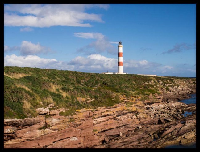
Chapter 12 (Tain, Invergordon and Dingwall) covers my travel southward from Golspie to the historic town of Tain; the Pictish areas around Portmahomack and Tarbat Ness (another worthwhile diversion from the NC500 route). From there I travelled to Nigg, to Invergordon (a somewhat sad and decrepit town) and on to Dingwall (with a further diversion to Strathpeffer). The Chapter concludes with a detour – a modest proposal to abolish unearned titles. The larger Chapter 12 file is here (2.2MB). The smaller Chapter 12 file is here (510KB).
Chapter 13 ( …end of the Road) first identifies some omitted topics – whisky, women of distinction from the north Highlands, crofting, and flora and fauna as well as an omitted destination – the Black Isle. This Chapter concludes with a section ‘Whither the NC500’ which reviews some ot the strengths and weaknesses of the current NC500. This Chapter is available here as a downloadable file (165 KB).
The entire book is available for download as a large file (41.8MB ) or as a smaller, lower quality file here (8.8MB).
